
Back to Introduction & Lesson Plans at a Glance
Introduction
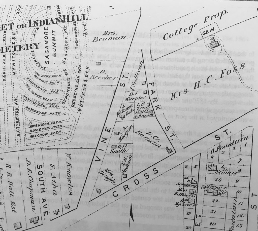
This lesson plan focuses on how neighborhoods are developed and highlights the earliest known subdivision in Connecticut laid out by a free black man for black homeowners. The Leverett Beman Historic District is listed on the Connecticut Freedom Trail.
Lesson Objective
By investigating the Beman neighborhood and then designing their own, students will be able to list and justify aspects of a successful neighborhood and its role in our lives.
Grade Level
3 to 6
Introductory Discussion Questions
Begin with a classroom discussion about communities and neighborhoods.
Q. What is a community?
A: It is a group of people sharing a common space or interest. Community usually refers to a social unit larger than a household. A community is a group or society helping each other. There are different types of communities which have various purposes. For instance, a community can be defined by geographic boundaries. This can be further divided into categories such as rural or urban. Or a community is defined by people who share the same interest or passion. Another type of community is one where people work in the same profession or undertake the same activities. What types of communities do you belong to?
Q. What is a neighborhood?
A: It is a geographically localized community within a larger city, town, or suburb. Neighborhoods are often social communities where people know each other. Where is your neighborhood? Where do you live?
Q. What do we do in neighborhoods and communities?
A: We make friends, work, go to school, eat, shop, and play
Q. Where do people interact with each other?
A: work, stores, churches, schools, houses, parks, streets, sidewalks, etc.
Q. What do we need? What resources can we find in our neighborhood?
A: Food , safety and protection (fire, police), health (hospitals), recreation (parks, gyms, swimming pools), businesses (places where we work), stores (food, clothing, etc), religious institutions, government, communication (post offices, phones, internet)
Q. Why do places change? What evidence do you think you could find in your neighborhood to show it has changed over time? What do you think your neighborhood looked like 50 years ago? How about 100 years ago?
Q. How can you find out about these changes?
A: Research on the Internet, from librarians and/or historians, by asking a grandparent or someone who has seen your neighborhood or community change, by looking at old photographs and maps.
Q. How do we share space? Who or what do we share space with?
A: people, animals, natural and built environment.
Q: What do you see in your neighborhood that lets you know people share space?
A: sidewalks, community gardens, shared driveways, streets, lights, telephone/cable poles, parks, etc.
Q: Why should we share our spaces?
Lesson Activity/ Procedure
1. After discussing the different aspects of our neighborhoods today, students will explore the Beman Triangle neighborhood of Middletown using the story link below:
The Beman Triangle in Middletown
2. Once the students have investigated the Beman Triangle, they should meet in groups to brainstorm responses to the question:
How did the community of the Beman Triangle support the lives of the people who lived there?
3. Now students will design their own neighborhood. The teacher can post an anchor chart in the room listing what kind of things to consider while designing their neighborhood. The following questions could be good prompts for kids to think about prior to their own design:
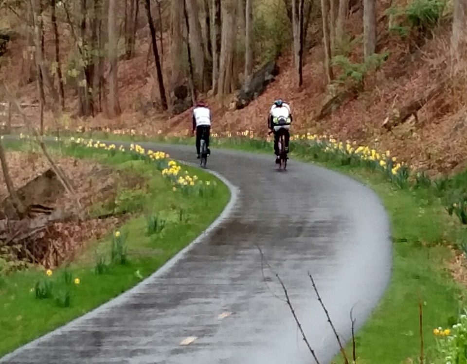
Do we all want to drive cars or do we want to be able to safely walk and bike?
Do we want bike lanes/sidewalks?
Do we want services nearby or do we want to travel to them?
If we want services, which ones? Food store? Medical? Pharmacy?
How about access to a highway or train? Are there noise concerns?
Do we want public parks/beach/pools or will everything be privately owned?
Where should the library be located?
How will this neighborhood work for the elderly? Children? Tourists?
In case of evacuation can people get out?
What should be located near the school?
What buildings should be located near each other?
What buildings need parking?
What buildings need quiet near them?
Where should a school be located?
Should businesses be together?
Anchor Chart
How do the following concerns affect a community?
Noise
Transportation (walking, bike, car, bus, train, sidewalks)
Speed of traffic (for ease of driving and safety)
Safety (from traffic, access to police, fire, hospital)
Recreation (types and access)
Types of businesses/jobs (stores, factories,
Types of housing (apartments, houses)
Space (yard sizes, parks)
Street lighting
Night darkness
4. Students then complete the planning chart and then draw their neighborhood using the Beman Triangle plat map as a model.
Planning Chart Link
5. Exit Slip: On a scale of 1-10 (10 being most), how important is the design of a neighborhood to the well-being of its families? Why?
______________________, ________________________, and _________________________ are the three most important aspects to consider when planning a neighborhood.
Lesson Resources
Where I Live: Connecticut, Chapter 4 “Cities & Towns”
“My Town: Middletown”
See “A Family of Reformers: The Middletown Bemans,” African American Connecticut Explored (Wesleyan University Press, 2014)
An illustrated history of the Beman Triangle and its residents.
More information about Wesleyan University’s Beman Triangle Archeology Project
For more about Middletown:
Middlesex Historical Society
For more about Amos Beman’s abolitionist work:
Connecticut Explored : Black Abolitionists Speak
For another neighborhood created by black and Paugusset people for themselves, learn about Little Liberia in Bridgeport:
https://freemancenterbpt.com/little-liberia/
https://bportlibrary.org/hc/african-american-heritage/mary-and-eliza-freeman-houses/
Word Wall
Community, neighborhood
State Standards
Alignment
GEOGRAPHY
GEO: 3.1-3.3;
GEO 3.7-3.9 Human Population: Spatial Patterns and Movement
Compelling Question:
· Why do you live where you live?
Supporting Questions:
· Who controls the use of land and resources?
· What factors, besides economic ones, cause a person to move to a certain location?
· What attracts a person to a town or city today? How is that different from what may have attracted them there in 1800?